Survey Planning
Interactive illumination testing
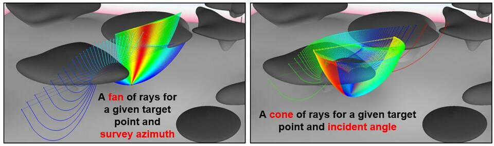
Need to know how selected target points are illuminated? Click on them!
Need to know how illumination changes for different azimuth or incident angle? Change angles interactively!
Target-point oriented modelling is like a fast-track survey planning tool on its own.
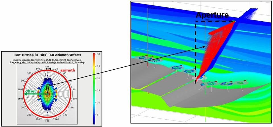
Rose diagrams
 Interactive survey planning is not enough?
Use target-point oriented modelling (illumination rays) to generate rose diagrams related to selected target points:
- Direct indication of useful azimuth and offsets.
- Access to contributing rays
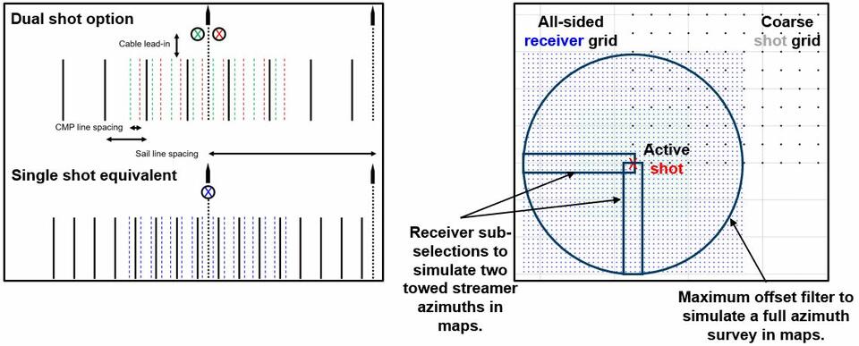
Best survey area
Find most efficient shot and receiver areas using areal filtering and survey domain mapping. Test whether your survey setup fits the purpose before wasting money in the field.
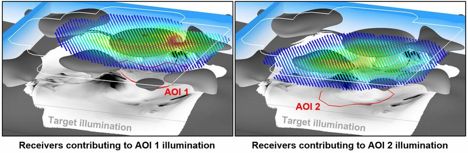
Advanced illumination mapping
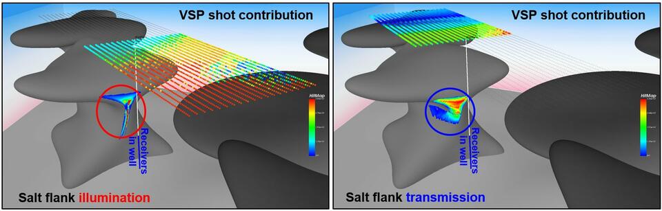
Need to generate illumination maps on steep targets or under overhang zones? Need to map transmission points in addition to reflection points? Need to find the shot points contributing to the area of interest? Or the most beneficial offset, incident angle, or receiver depth range?
Use advanced illumination mapping inside NORSAR-3D.
Survey flexibility allowing for speed and efficiency
Replace multi-gun configurations by single shot surveys to save modelling time. Use analytic surveys for covering several survey options in one go. If done smartly, seismic forward modelling is by no means any trail and error process.